Link to the news article with the Google Maps image used on the cover.

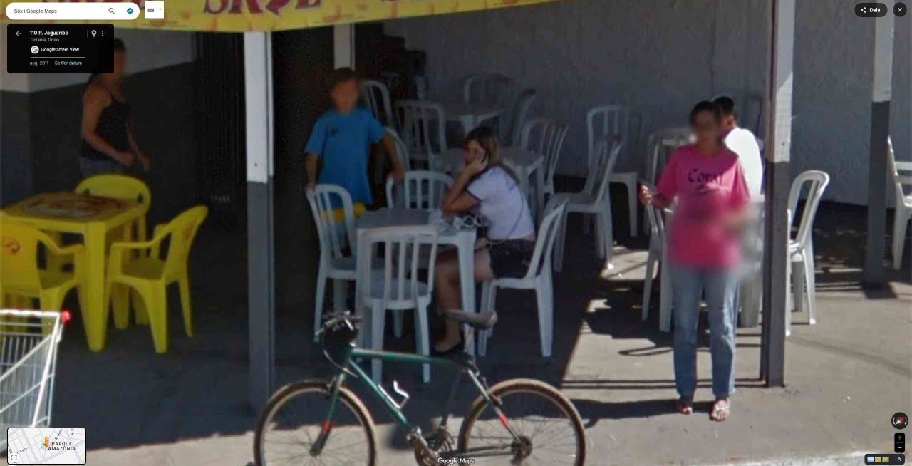
A photo taken by Google Street View, in August 2011, shows the singer Marília Mendonça (1995-2021), at the age of 16, sitting at the table of her mother’s bar, in Goiânia. In the image, which reverberated on social networks recently, she appears in school uniform, talking on the phone, next to her brother, João Gustavo.
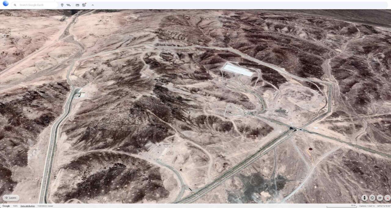
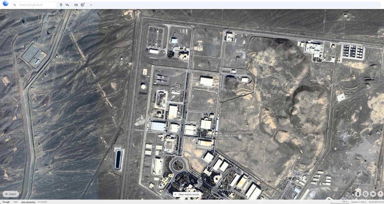
US President Donald Trump posted on his social networks an announcement of an attack on three Iranian nuclear power plants: Fordow, Natanz and Isfahan. According to him, the bombings were carried out by the US military, which would already be out of the country’s airspace. The main target of the bombs would have been the Fordow plant.
Locations of nuclear sites
Fordow:

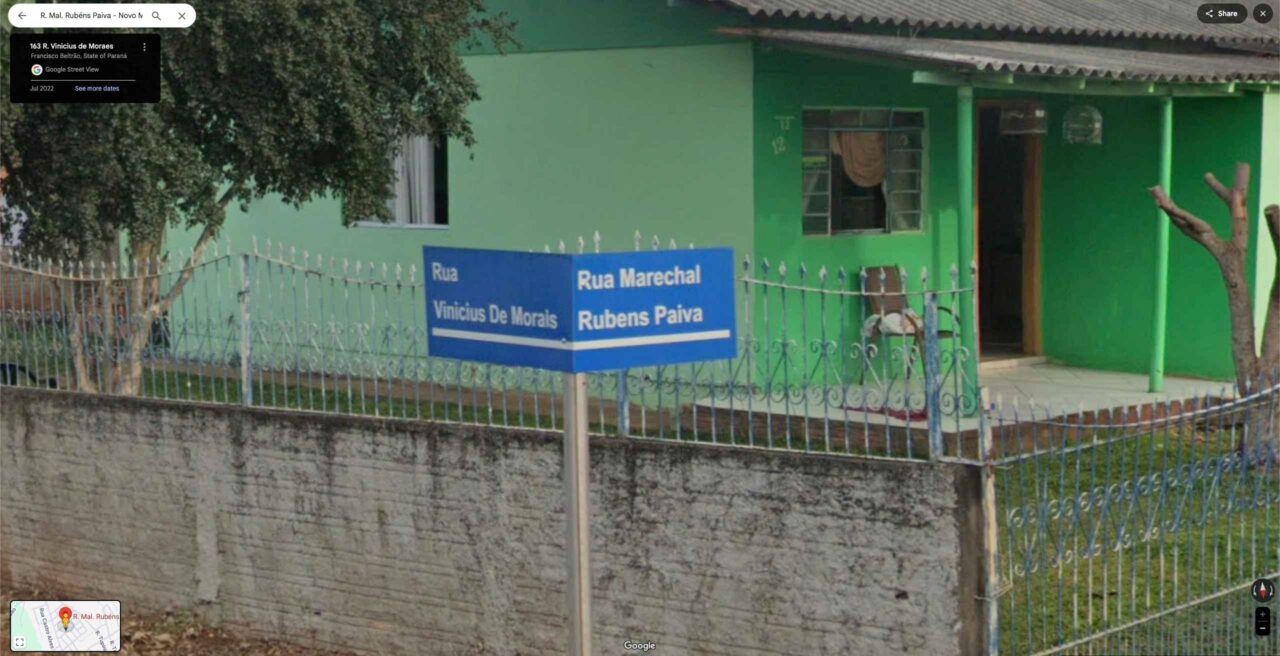
The road was named more than 30 years ago, but only now, after the repercussion of the film Still Here, winner of the first Oscar in Brazil’s history, was the mistake realized. And the error occurs due to the inclusion of the term “Marechal” […] Source: Bem Paraná
Link
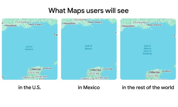
Google Maps now shows the “Gulf of America” in place of the “Gulf of Mexico” for users on both web and mobile in the United States. It made the change after the Trump administration formally changed the name today of the body of water spanning between the eastern coast of Mexico and Florida. Google says it follows the GNIS, or Geographic Names Information System, a US database of location information. Source: The Verge
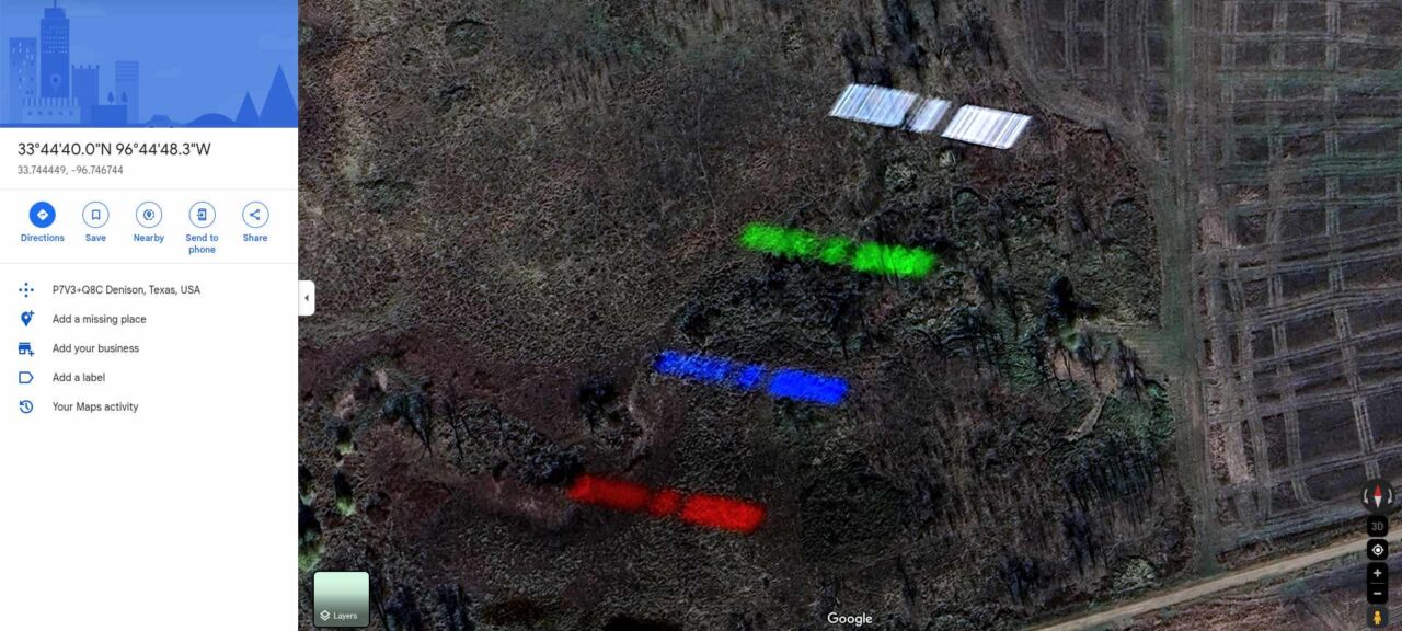
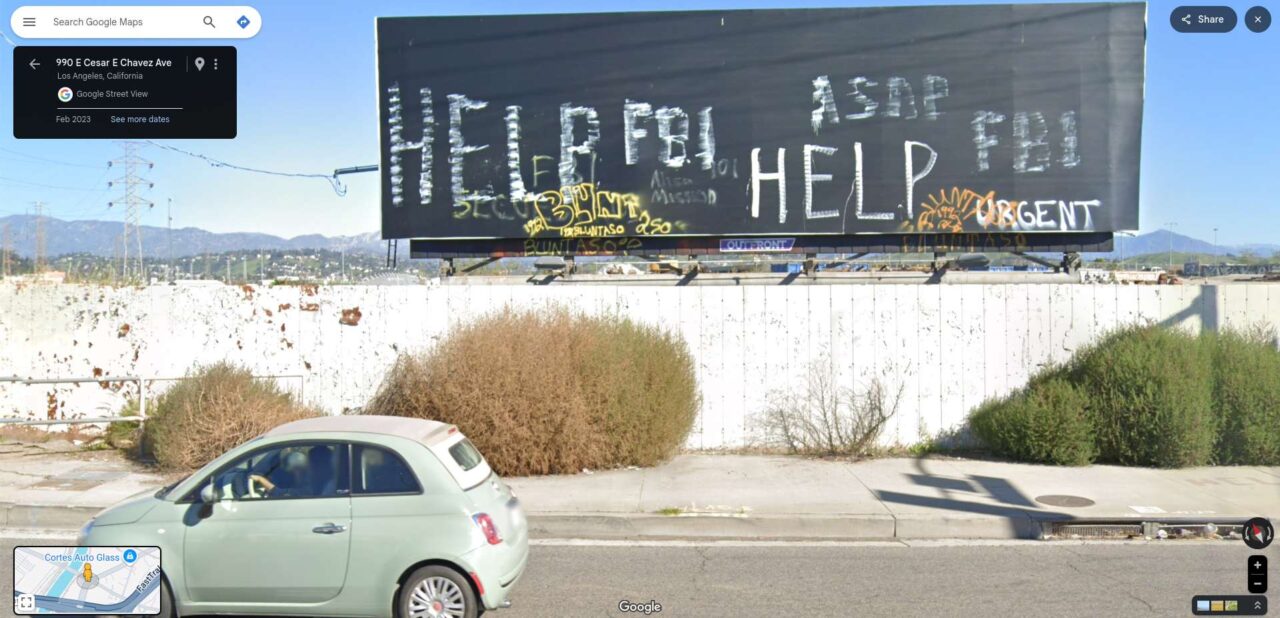
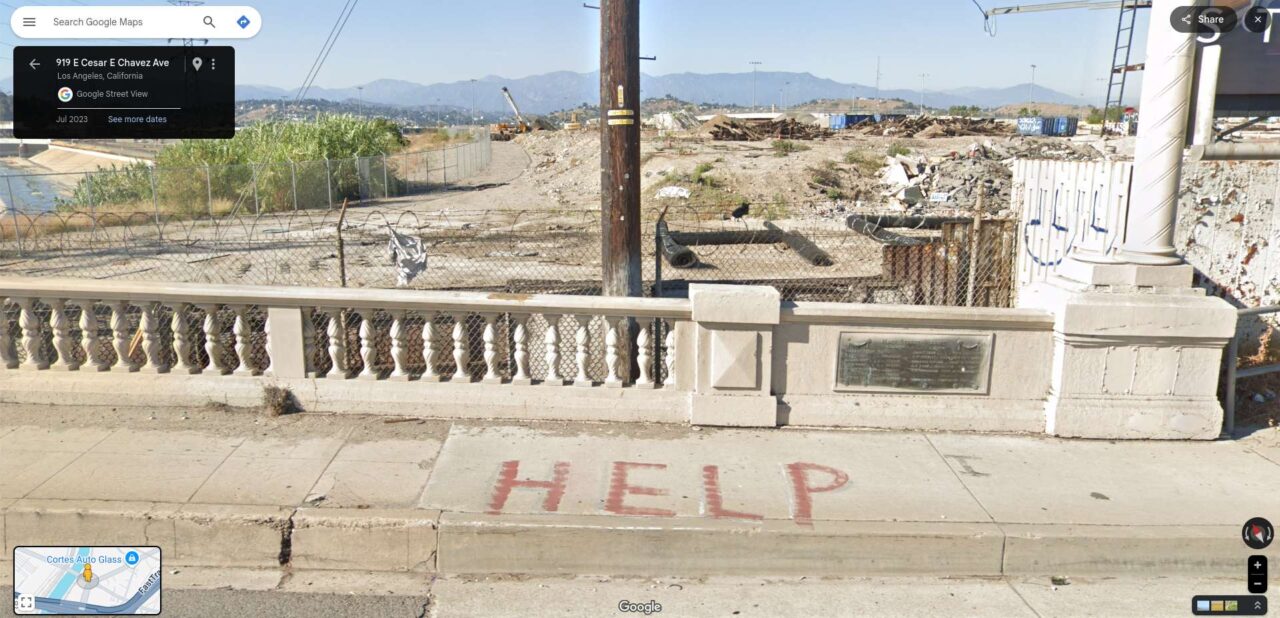
Yesterday, here on the Streetviewfun website I posted about an image taken via satellite where there is a request for help, and it is available on Google Maps, messing with the imagination of users and there is already reason these messages are written on that land and already information about who wrote them.
According to the Newsweek website, a police spokesperson issued a statement regarding this case.
A spokesperson for the Union Pacific Police Department told Newsweek: “Photos circulating on Google maps that show the word ‘help’ on Union Pacific property were created about a year ago – no one was or is in danger. A man trespassed on Union Pacific and other nearby properties to repeatedly create these misleading messages. We want to remind the public that it is illegal – and more importantly unsafe – to trespass on Union Pacific property.”
According to the Los Angeles police, the property belongs to the Union Pacific Railroad.
The messages, however, do not appear to be current, as they were already written almost two years ago, in 2023, according to these Street View images from that year.
#1: Link
#2: Link
(more…)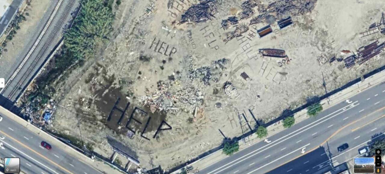
The online community is in a frenzy after recent satellite images disclosed several distressing ‘HELP’ signs constructed from debris in an undisclosed location in California.
[…]These images, captured via Google Earth, reportedly first surfaced between September 2022 and June 2023. They depict large-scale signs clearly visible from the sky that spell out “HELP.”
Additional elements in the images suggest ominous undertones, with words like “FBI,” “LAPD,” and others also clustered nearby.
Source: Vigilant News Network
Google Maps Link
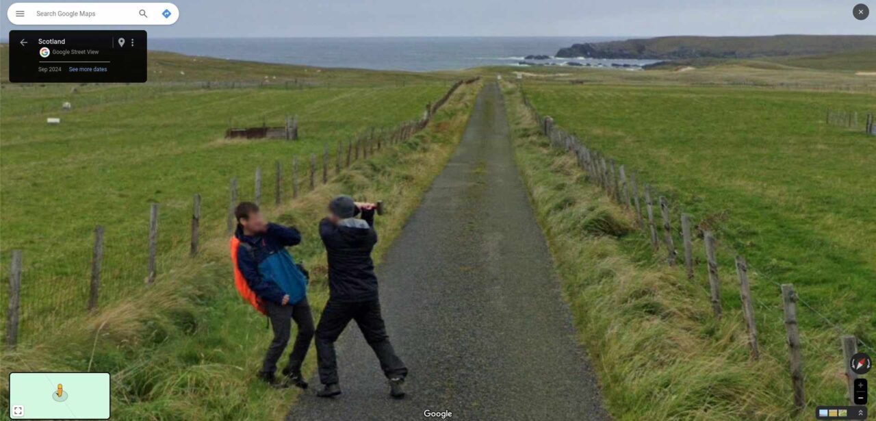
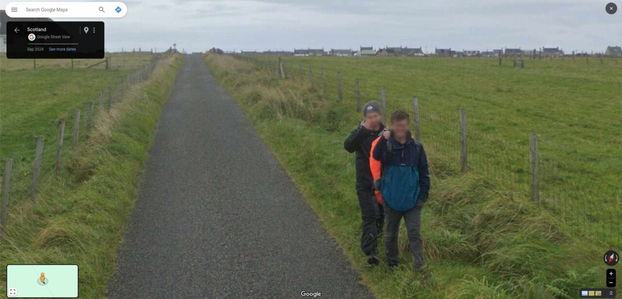
Gideon Futerman says he was on the North of the Isle of Lewis in Scotland when the pair played the prank. They spotted the mapping camera and decided to create a “masterpiece”. The camera caught him pretending to hit his friend with “a geological hammer”.
[…] Source: Daily Record
Over the summer, I went to the very North of the Isle of Lewis on a field trip to map the geology there with a close friend of mine. The google street view car went past. We had a geological hammer. The following masterpiece, now on google street view, was the result pic.twitter.com/NIBPnxuIl5
— Gideon Futerman (@GFuterman) October 29, 2024
Link
In the end, they like Google Maps. Link
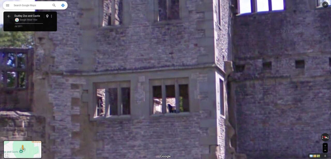
Eerie sightings have occurred before at the site including a ‘little drummer boy ghost’ and the so called ‘grey lady’. Source: Birmingham Live