
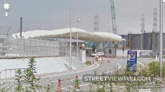
New images are now available on Google Street View from the 2011 tsunami and earthquake-affected areas in Japan. This is the entrance to the Fukushima Daiichi Nuclear Plant. Google are also publishing imagery of new areas within the Fukushima Exclusion Zone, including the abandoned towns Ōkuma and Futaba.
– We hope that providing this new street-level imagery on Google Maps can make the memories of the disaster relevant and palpable for future generations, says Kei Kawai, Group Product Manager, Street View.
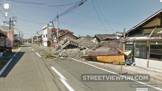
Futaba Machi, Fukushima Prefecture:
Larger
Similar Street View images
 Google Earth images show flooding in Rio Grande do Sul
 We’re adding 4 new images daily in September
 The latest Google Street View in South Korea?
We’re adding 4 new images daily in November
The latest Google Street View in South Korea?
We’re adding 4 new images daily in November
 More new images in August
 Street View Show!
 Google Street View in North Korea?
 Google Street View cars from the airport